Arkansas
Weather Report


Content Copyright David Harrison © 2016
All rights reserved.


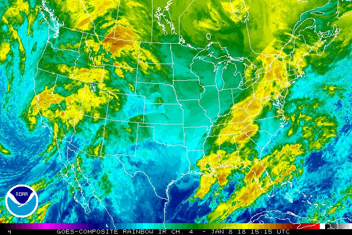
Infrared Satellite CONUS
 Forecast
Storm Center
Safety & Training
Weather
Facebook
Twitter
>
>
>
>
>
>


This image is taken in the infrared band of light and show relative warmth of objects. Colder objects are brighter and warmer objects are darker. Lower layers of clouds, generally warmer and lower in altitude, are colored gray. Colder and generally higher clouds tops are highlighted in colors. Infrared imagery is useful for determining cloud features both at day and night. This image is updated every 15 to 30 minutes. To loop this image, click here.
